A vision for the next generation of water infrastructure — one intelligence layer connecting reservoirs, aquifers, treatment plants, farms, and cities into a single living system.
From early wells and storage canals to industrial dams and concrete pipelines, humanity has always adapted its physical systems to survive. Today, rising demand and climate volatility call for a new paradigm—a shared layer of intelligence.
Local, gravity-fed networks connecting communities to nearby surface sources.
Mega-scale concrete barriers storing runoff, powering cities, and routing major pipelines.
High-pressure pipelines, pumps, and treatment plants supplying exploding urban populations.
Dynamic, bi-directional intelligence systems routing resources reactively in real time.
Expanding demographic basins demanding unprecedented volume.
High concentration of municipal demand straining localized supply chains.
Unpredictable cycles of intense monsoons, droughts, and changing patterns.
Demands for reliable irrigation systems to sustain food production with less waste.
Groundwater depletion outstripping replenishment cycles globally.
Water is local and volatile, yet our management tools are blind to the larger grid. We build dams without mapping groundwater; we allocate irrigation without real-time soil feedback.
Our water assets operate in total isolation. Reservoirs, distribution grids, agricultural districts, and municipal treatment works run independently, communicating via slow, manual logs.
Without unified visibility, allocations are built on historical estimates rather than actual soil dynamic sensors, reservoir telemetry, and predictive weather modeling.
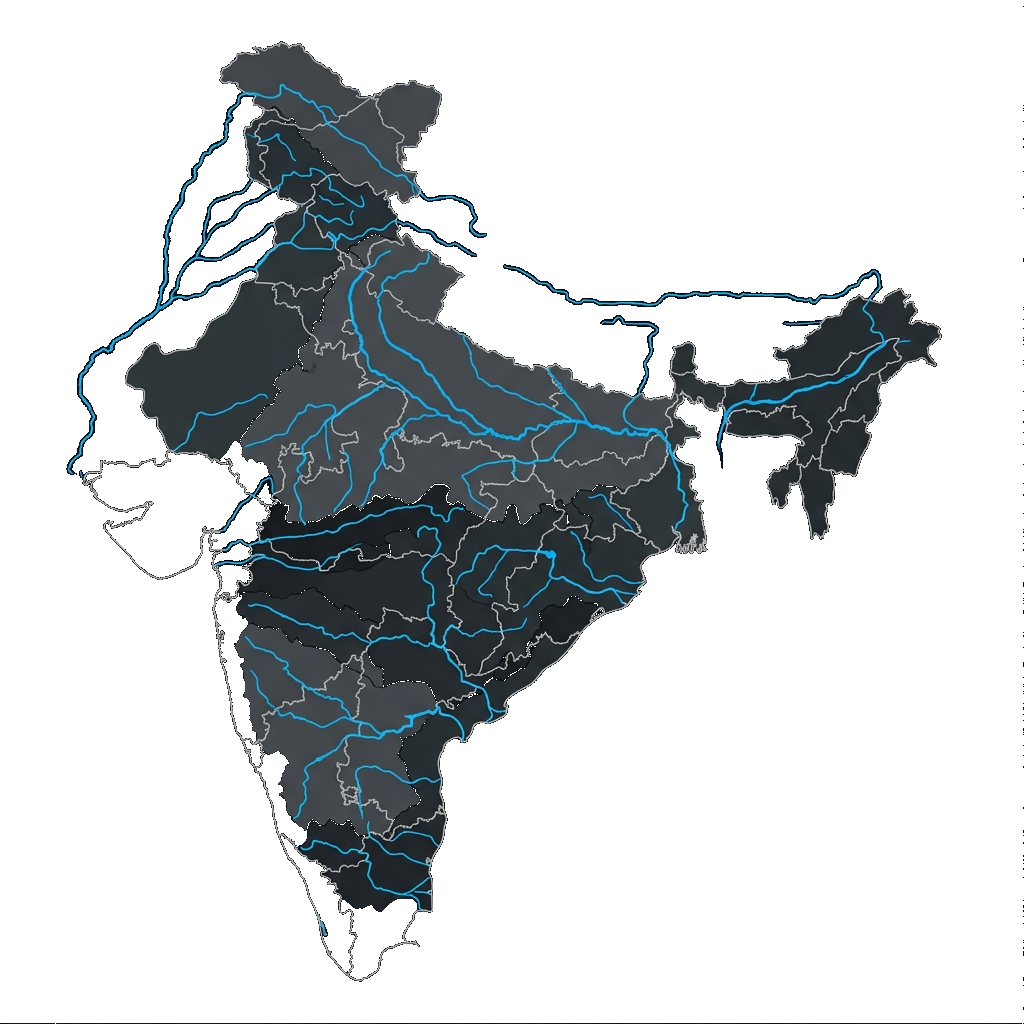
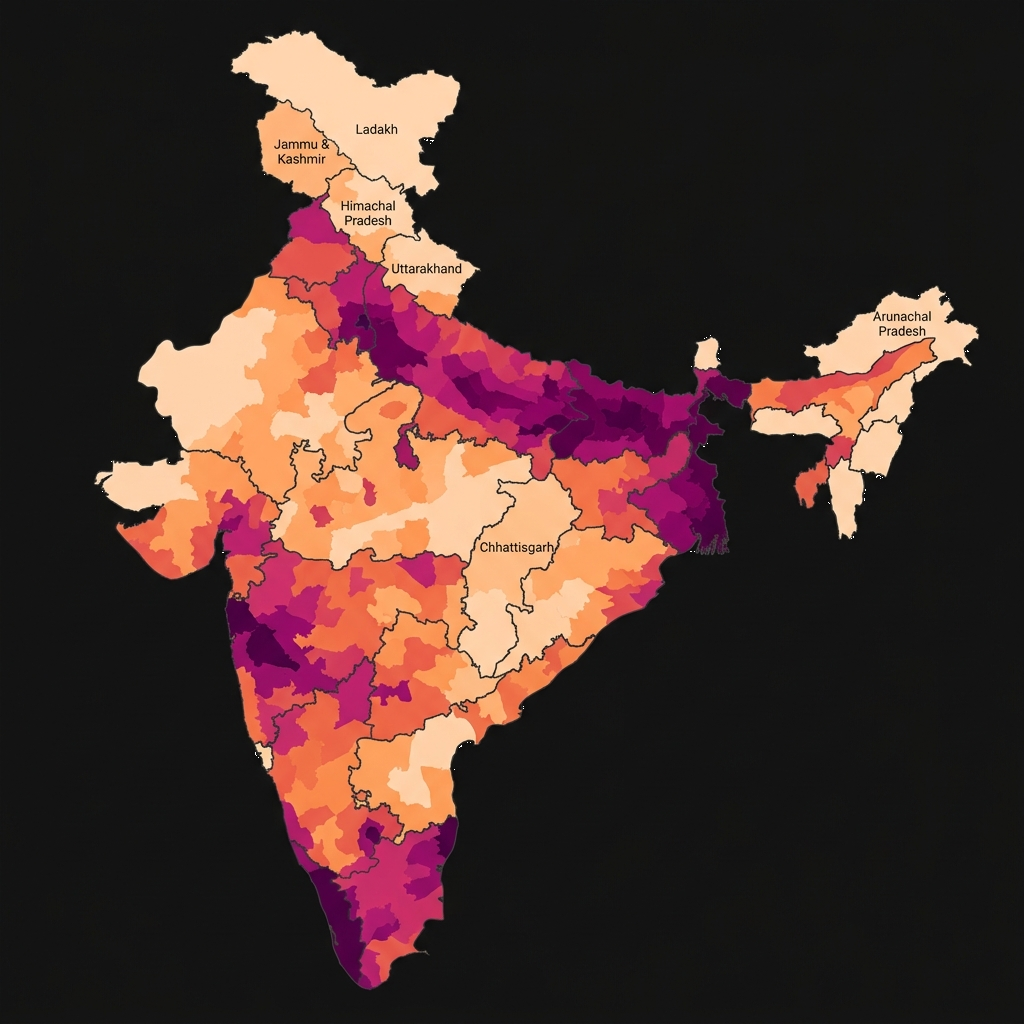
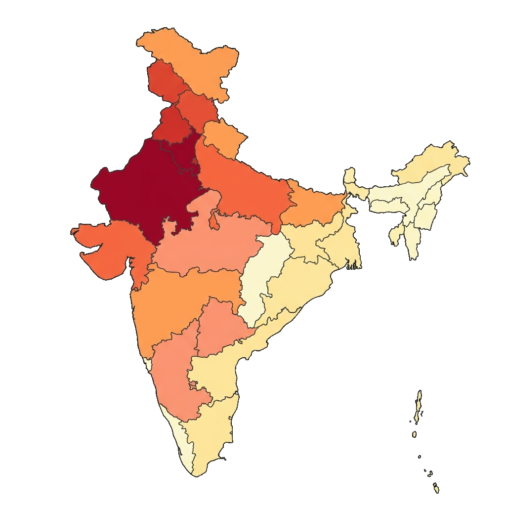
India holds 18% of the global population but just 4% of the world's fresh water resources. This mismatch is compounded by extreme seasonal and spatial variation. Select a layer below to overlay the spatial data twin of India's hydrology, demographic density, and localized scarcity.
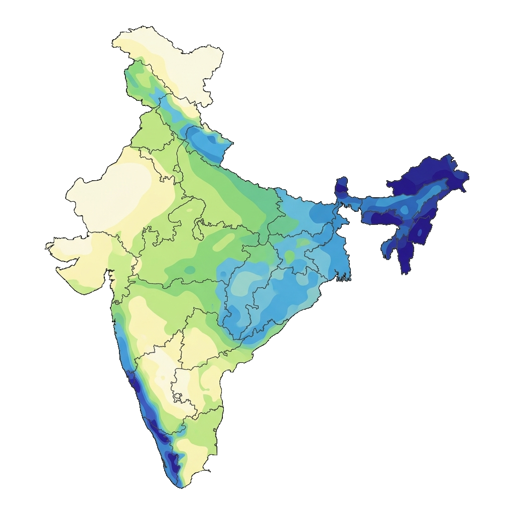
India is struggling to capture its 4,000 BCM of annual precipitation as climate volatility collapses monsoons into extreme, short bursts. The lack of storage turns vital rains into destructive runoff rather than drinking reserves.
India's major river basins are facing severe ecological strain. Out of the 1,123 BCM of theoretically utilizable surface runoff, silting, pollution, and structural bottlenecks are actively shrinking the volumes reaching urban and farming networks today.
Unprecedented urban migration is forcing India to sustain 18% of the global population on just 4% of the world's fresh water. This stark mismatch is triggering daily municipal supply crises as dense cities outgrow their localized watersheds.
Over 600 million people are actively facing high-to-extreme water scarcity today. Rapidly accelerating groundwater depletion and unregulated extraction are driving major city aquifers toward complete collapse, threatening immediate domestic security.
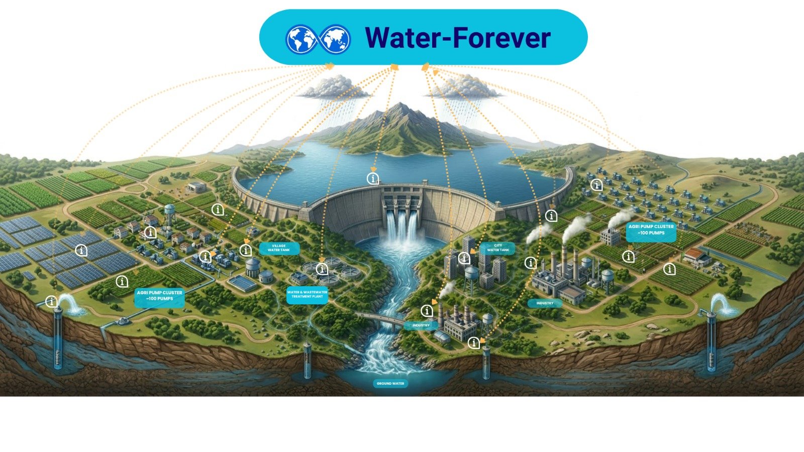
Water Forever acts as the central brain of the water system—observing shifting weather patterns, connecting scattered physical assets, understanding localized demand, predicting supply stresses, and acting before problems occur.
By overlaying existing physical pipes, reservoirs, and pumps with an open, real-time digital telemetry layer, we transform isolated infrastructure into a single responsive network.
We read the live state of the entire system—tracking everything from snowpack levels on mountain peaks to real-time recharge rates in underground aquifers.
We link scattered data sources, secure APIs, and telemetry pipelines, enabling independent reservoirs, farming pumps, and cities to securely talk to one another.
We translate raw sensor streams into a clear visual dashboard, giving utility managers and municipal planners a single, unified view of watershed health.
We calculate upcoming stresses, analyzing weather patterns, soil moisture indexes, and population consumption spikes to warn of vulnerabilities before they happen.
We optimize resource allocation, automatically routing surplus run-off to groundwater basins and balancing reservoir releases with downstream demands.
Today, reservoirs, farms, treatment plants, and cities operate in isolation—disconnected by design. The Waterfall Grid acts as a shared digital layer, letting physical infrastructure exchange real-time telemetry to coordinate water flow as one coordinated system. Hover over the map or cards to see how the elements connect.
Collects snowpack satellite imagery, stream inflow sensor data, and structural dam metrics. It automates spillway release gates to safely capture surplus rain run-off while maintaining optimal regional storage reserves.
Links piezometers and flow meters across regional aquifer networks. Tracks real-time water tables and drawdown rates to prevent over-extraction and enforce localized recharge schedules.
Monitors farm irrigation meters, crop soil moisture probes, and local solar-powered pump clusters. Integrates evapotranspiration telemetry to deliver targeted volume allocations, reducing dry-season waste.
Monitors water level gauges and pressure sensors across village water tanks and towers. Guarantees safe and reliable domestic pressure regulation for decentralised rural communities.
Monitors metropolitan water grids, city tanks, and industrial recycling loops. Automatically flags pressure drops to locate leaks instantly, balancing high-density consumption with strict sustainable withdrawal limits.
The system's unified orchestrator. Reconciles water accounting datasets, models climate scenario testing, and provides transparent, shared governance reports for public trust and ecological safety.
Enduring public infrastructure must not belong to a single vendor or state. Water Forever is built as an open, interoperable system so everyone can build, integrate, and verify.
Any utility operator, device developer, or NGO can build extensions and query datasets safely without gatekeepers.
Standardized API formats connect telemetry across legacy SCADA systems and new IoT soil monitors without lock-in.
Every predictive algorithm or optimization pipeline developed is shared back to strengthen the wider water grid.
Built as public infrastructure. Deployed to last, secure, and adapt to climate extremes across multiple generations.
Download the official Water Forever Initiative Brochure for a comprehensive review of our operational guidelines, technological layers, and governance frameworks.
This document serves as an introductory brief for utility directors, municipal authorities, and regional stakeholders looking to understand the core Waterfall Grid deployment roadmap.
Download Brochure (PDF)
INITIATIVE BRIEF · 2026
Digital Water Infrastructure for Generations
waterfall-automation
"We do not inherit water from our ancestors.
We borrow it from our children.
Let us return it better."
Whether you are a utility manager, an enterprise seeking sustainable usage, a governmental planner, or an academic, your participation strengthens the digital water grid.
Founder, Water Forever Initiative
"The infrastructure of the 20th century was steel and concrete. The infrastructure of the 21st century is intelligence and collaboration. We are building the nervous system that water has always deserved."